- Details
Walks around Buninyong
Walkers have a choice of interesting tracks around Buninyong; some in the heart of town are easy for all, others are more vigorous as they climb the many steep volcanic cones ringing the township.
Blue Plaques Walk
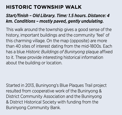
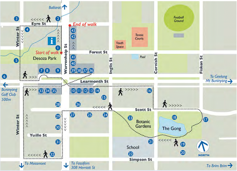
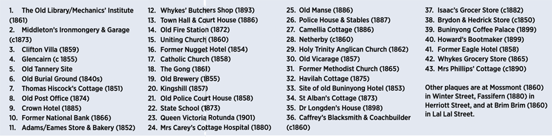
Map and key prepared for the 2021 Buninyong Visitor Guide.
Botanic Gardens
Gravel paths with gentle gradients wind amongst lawns shaded by mature trees and over small bridges crossing a small stream and ponds in Buninyong's atmospheric Lower Botanic Gardens. Facilities such as a rotunda, children's play areas, barbecues, and toilets make this restful place popular for picnics.
In the Upper Gardens, another level path skirts The Gong, with steeper tracks leading up to the Catholic Church and to Mt Innes.
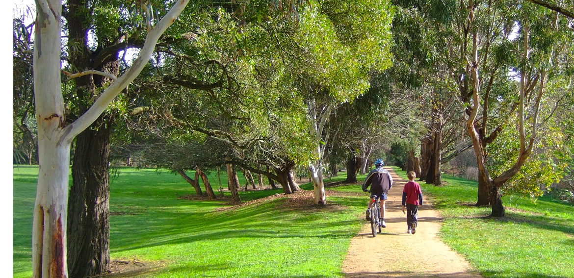
Union Jack Creek and Desoza Park
A level gravel path runs through Desoza Park for a kilometre or so along both sides of the Union Jack Creek, making an easy circuit walk. It is suitable for prams, wheelchairs and bicycles.
The eastern end of the park, next to the Information Centre, has a rotunda, children's play area, barbecues, and toilets.
The best nearby parking is on the NW corner of Learmonth and Warrenheip Streets, next to the Crown Hotel
- De Soza Park circuit walk
Distance 3.7 km; Time: 1 hour, 10 minutes; Difficulty: Grade 1
See De Soza Park circuit walk map and description
De Soza Park - Coleman's Springs
Not signposted, follow map in Heritage Walks booklet
Distance: 3.5 km; Time: 1 hour, 15 minutes ; Difficulty:Grade 1
De Soza Park - Mt Innes
Not signposted, follow map in Heritage Walks booklet
Distance: 3.9 km; Time: 1 hour, 30 minutes ; Difficulty: Grade 3 (one steep hill).
Buninyong - Bird Park Circuit
Start at De Soza Park. Distance: 4.7 km; Time: 1 hour, 25 minutes (more if Bird Park is visited); Difficulty: Grade 2.
The Buninyong Bird Park Circuit is documented fully on Walks Around Buninyong & District, a website featuring local walks with provide plenty of support information. It has a detailed Summary Sheet, Walking Notes, Background Information on points of interest and a downloadable Geo-referenced Map. The website also allows for walkers to contribute photos and data concerning birds and plants identified along the walk.
Union Jack Reserve
A 72 hectare area of bush on the north-east corner of Buninyong that was extensively mined in 1857. A maze of bush tracks wander through the old gold mining area.
Two walks are sign-posted and self-guided:
- Short Walk: 40 minutes, Difficulty: Grade 2p
- Long Walk: 2 hours, Difficulty: Grade 3. Includes the Locomotive Mine, one of the few accessible mine shafts left near Ballarat.
A free self-guided map from Parks Victoria is available from the Buninyong Information Centre or is downloadable here
Mt Buninyong Walks
-
Crater Walk
- South Walk
Difficulty: Grade 4. Narrow track, steep sections, steps. Ideal first training for the Kokoda Track. If the Kokoda Track was a 10, this would be a 3. - Buninyong - Mt Buninyong Circuit
Distance 12 km; Time: 3 hours, 30 minutes; Difficulty: Grade 3. There are three short steep sections.
Parking: On the Mount - in Blackberry Lane near the junction with Mt Buninyong Road at the bottom of the Reserve (signposted). In Buninyong township - the best parking is on the NW corner of Learmonth and Warrenheip Streets, next to the Crown Hotel
Goldfields Track: Buninyong - Mt Innes - Mt Buninyong
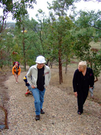
Climbing the last steep stage
of the track up Mt Innes
Part of the Wallaby Track section of the Goldfields Track developed by the Great Dividing Trail Association, the Buninyong Walk starts gently at the eastern end of The Gong, following the Yuille St reserve then climbs quite steeply up to Mt Innes where there is a seat and good views. From there, the track continues up to the summit of Mt Buninyong.
The Goldfields Track (Mt Buninyong to Bendigo) is 210 km. The Wallaby Tack (Mt Buninyong to Daylesford) is 90 km.
The Wallaby Track is made up of a number of shorter walks:
- Mt Buninyong Walk - Mt Buninyong to Whitehorse Bridge - 13km
- Whitehorse Walk - Whitehorse Bridge to Ballarat Railway Station - 7km
- Creswick Miners' Walk - Ballarat Railway Station to Creswick - 23km
- W. G. Spence Walk - Creswick to Mollonghip - 20km
A detailed map of the whole Wallaby Track with photos and commentaries on this section of the GDT is available from the Buninyong Information Centre for $9.50
See the Great Dividing Trail Associationwebsite for more info about the Victorian sections of the GDT.
See also the new Goldfields Track website which covers the 210 km Goldfields Track all the way from Bendigo to Mt Buninyong, via Castlemaine, Daylesford, Creswick and Ballarat. The website includes links to maps of the Goldfields Track embedded on both Garmin and Google Maps, that you can use or download on a smartphone or other mobile device.
Ballarat Walking Tracks
Ballarat Walking Tracks on the City of Ballarat's website is another useful resource with links to maps and descriptions of a range of interesting walking tracks around Ballarat and district
The current Buninyong Visitor Guide (below) is a handy guide to Buninyong. It includes maps, photos and lots of local information. Print copies are available from the Buninyong Information Centre.
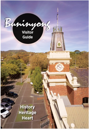
Buninyong Visitor Guide